NAVAREA, Coastal navigational warnings in force on 22-10-2024
Please refer to OFFICIAL sources, Inmarsat SafetyNET or international NAVTEX services, for more complete information.
UPDATED AT: 22-10-2024 07:30 UTC
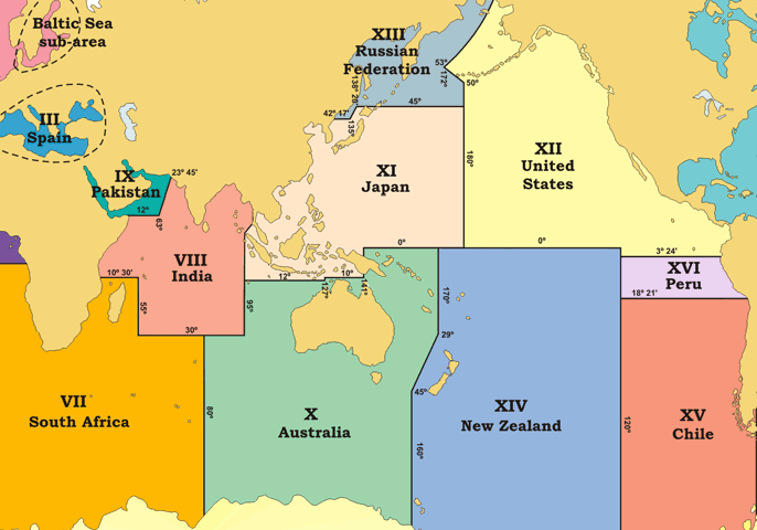
Navarea Warnings
Access Up-to-Date NAVAREA Warnings
Stay informed on your maritime journey with the latest NAVAREA warnings. Ensure your navigation is safe and secure by accessing real-time navigational alerts.
Open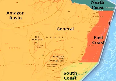
Coastal Warnings
Stay Informed with the Latest Coastal Warnings
Keep your coastal voyages safe by staying up-to-date with the most recent coastal warnings. Access critical information to navigate coastal areas securely and efficiently.
Open